In Finland and want to go further North? Then how about visiting Kilpisjärvi – a small town, or more like village, in the north-west tip of Finland, next to Norway and Sweden. This makes it a perfect spot to explore the other two countries in the North as well. Or just make the journey to the Three Country Cairn and then you’ve been to three countries at once!
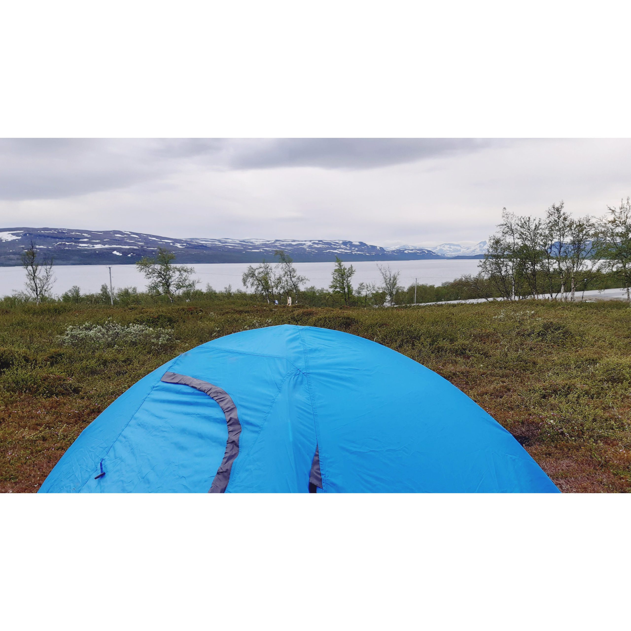
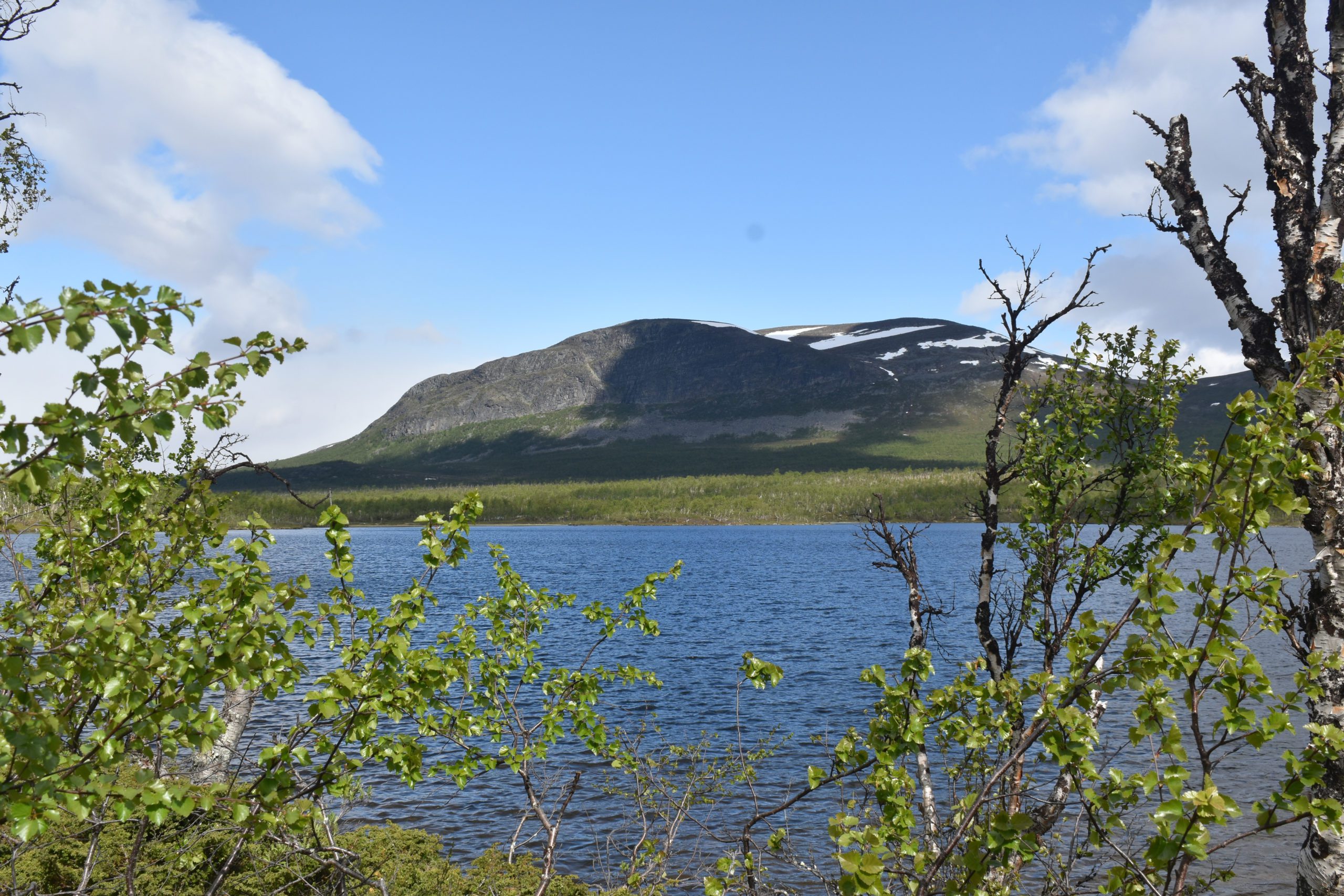
Sweden can be seen just across the lake. The Finnish-Swedish border runs along lakes and rivers for a long distance, up until Tornio. Kilpisjärvi is situated by a lake that goes by the same name. To get to the three-country point, we would have to cross this lake (by boat) or hike around it. Being so up north, the town also has a fantastic view to the Scandinavian mountains and is one of the few places in Finland with mountainous landscape. It’s also at the foot of one of the largest mountains in Finland – the Saana fell.
So, how did our journey to Kilpisjärvi begin? – We were already in Lapland for midsummer week and decided that we’d like to go up to Norway and camp-out for a couple of days. Well, that didn’t happen since we’d need to show a ‘health pass’ to cross the Finland-Norway border in the middle of nowhere. So we decided to go to Kilpisjärvi and hike there, instead. The three-country point has been on my bucket list for a while and the possibility of going there was exciting.
Getting to Kilpisjärvi
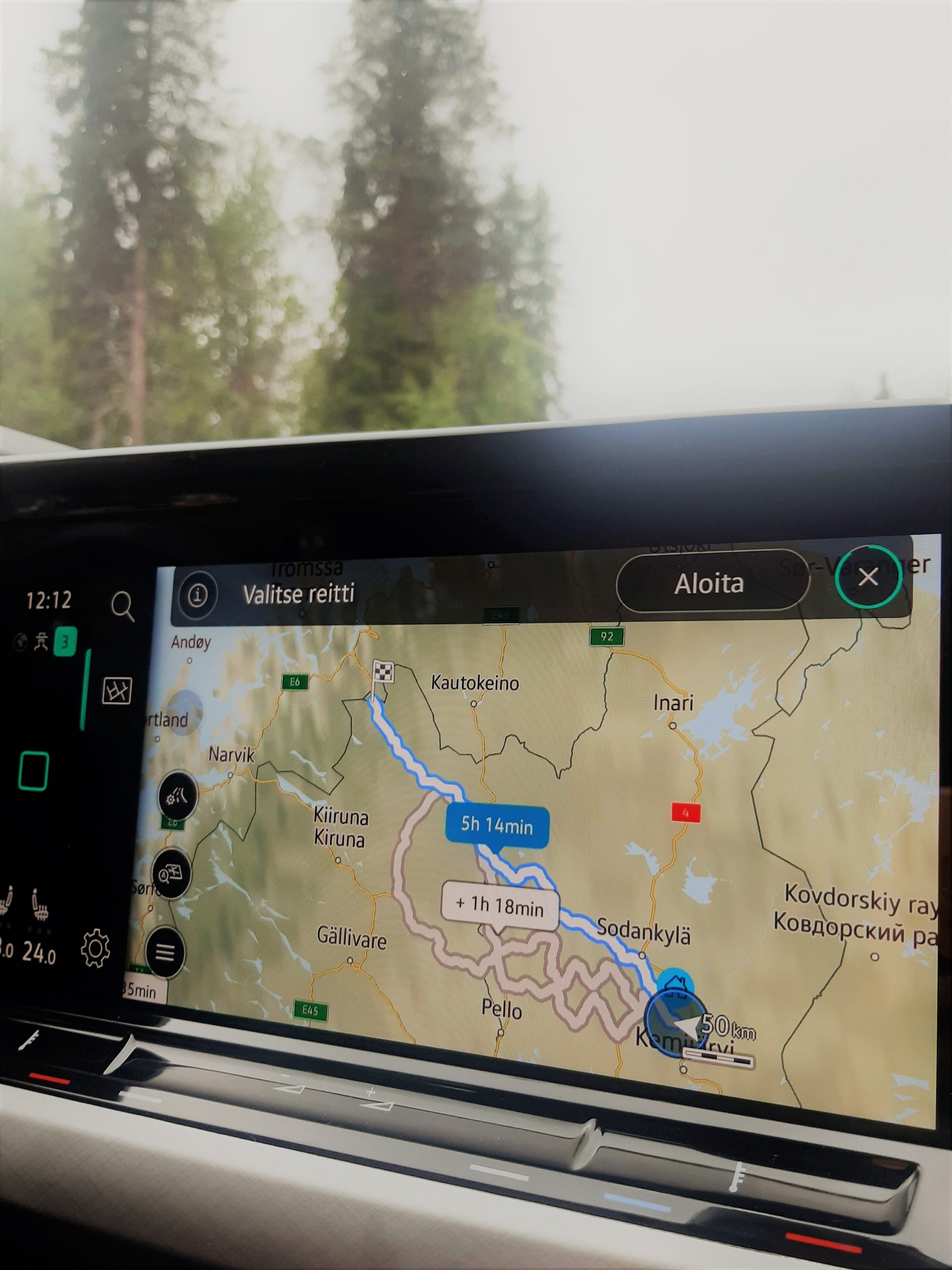
Starting the drive with a rental car from Pyhätunturi at noon, after a brunch, it took us about 7 hours in total to get to Kilpisjärvi. This was including the breaks and stops for sightseeing. The total drive time was about 5 1/2 hours. You can also get there from Rovaniemi and it takes the same amount of time. There are also shuttle buses running between Rovaniemi – Kilpisjärvi, more info here on nationalparks.fi.
Our route: Pyhä-Luosto -> Sodankylä (pass by) -> Kittilä (stop for lunch) -> Muonio (a town near the Swedish border -> along the border on the E8 highway up to Kilpisjärvi.
We took a few breaks at roadside parkings and a longer lunch break as well. I don’t have a driver’s licence (yet) so J is the only driver. The clouds started to clear as we drove north, the temperature was around 18 degrees. Mosquitos and flies were quite bothersome though. Don’t forget some herbal repellent or mosquito hat – believe it or not, summer in Lapland is filled with these annoying little creatures. For lunch, we enjoyed our mushroom-whitebean pasta by the river side at Kittilä.
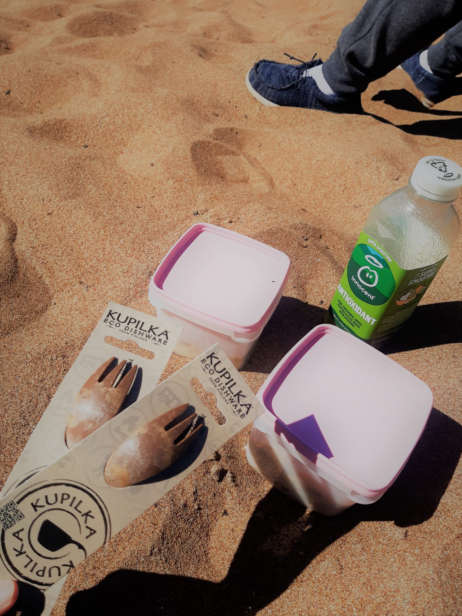
We carried packed meals that we had prepared before the journey and that was enough for the day and night camp out. Our dinner was couscous salad and we had snacks/chips with us too! I love the useful Eco Sporks we bought from Naava Nature Centre in Pyhä.


Points of interest:
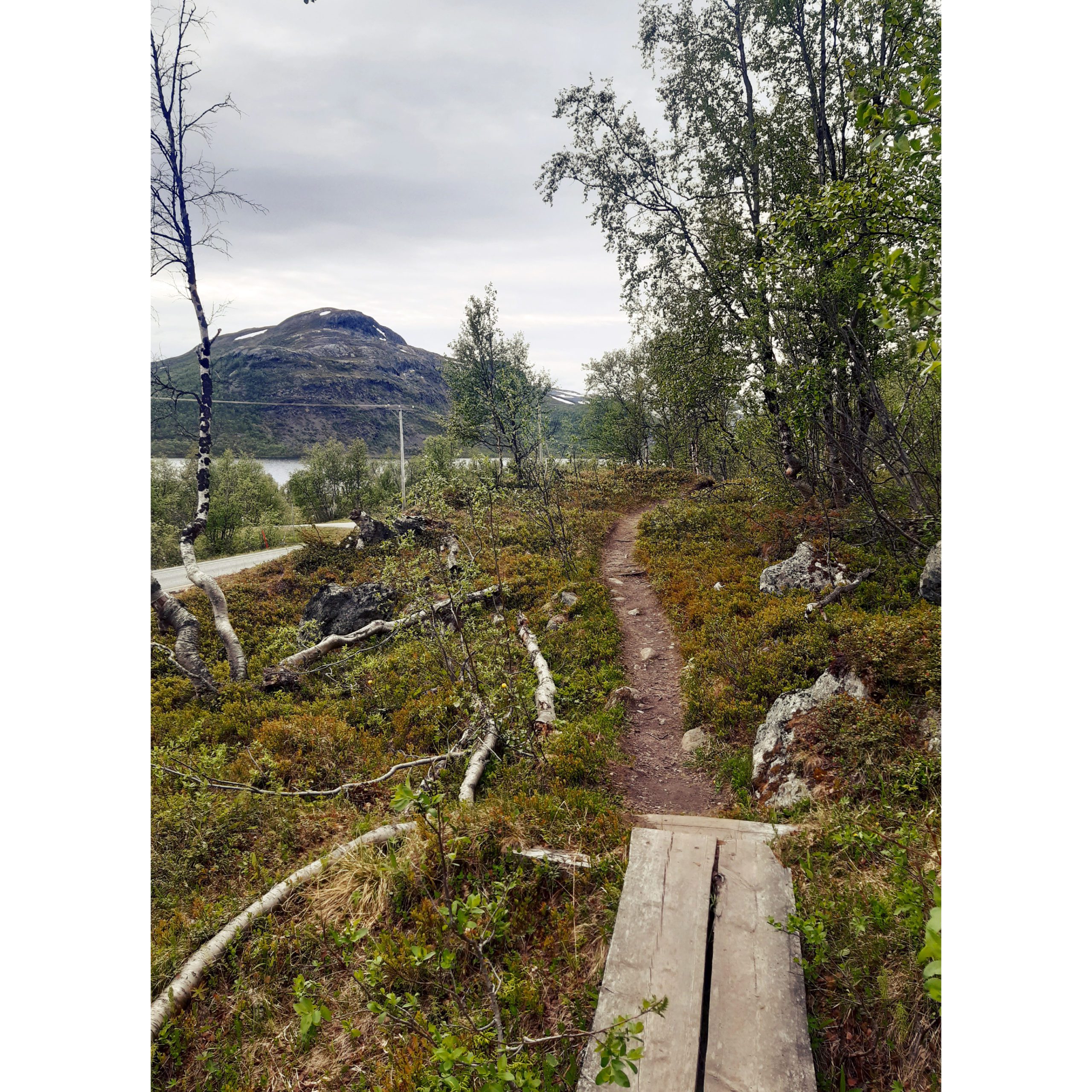
There was a view point to the Pallas-Yllästunturi fells that we stopped to check out. An interesting place we came across next was the Iito Mire [Iiton Palsasuo]! At some point between Muonio and Kilpisjärvi, we happened to see a sign pointing towards it and pulled over.
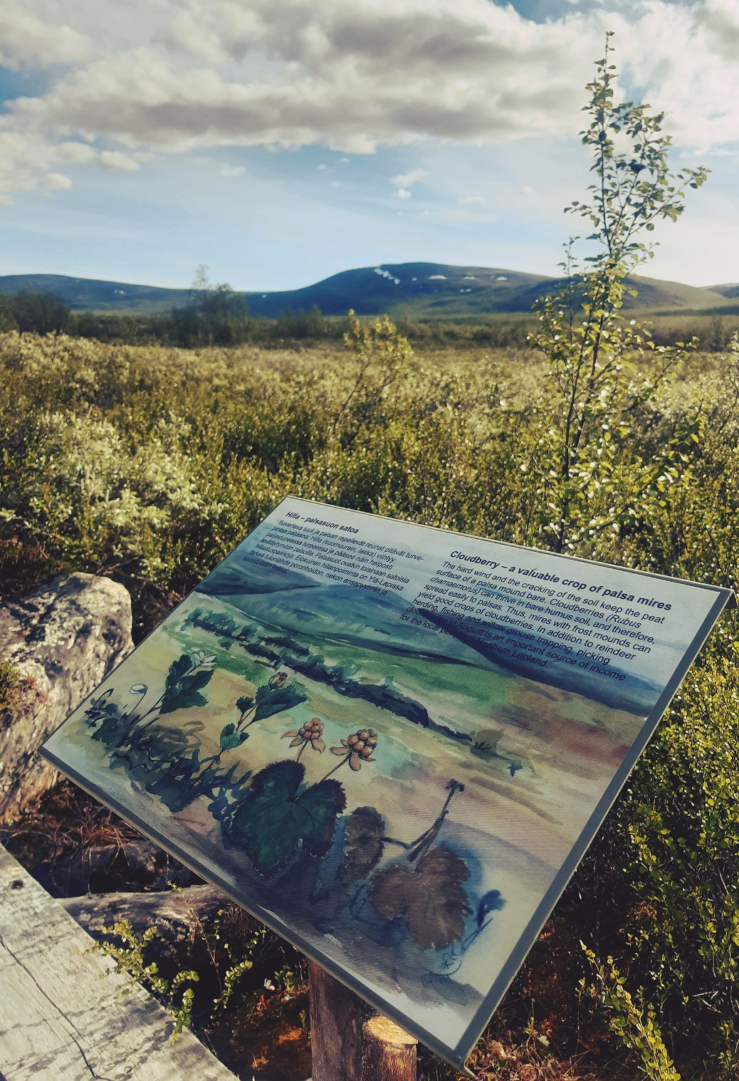
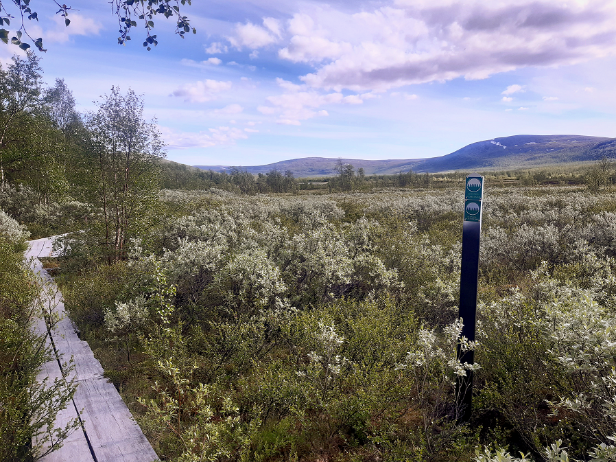
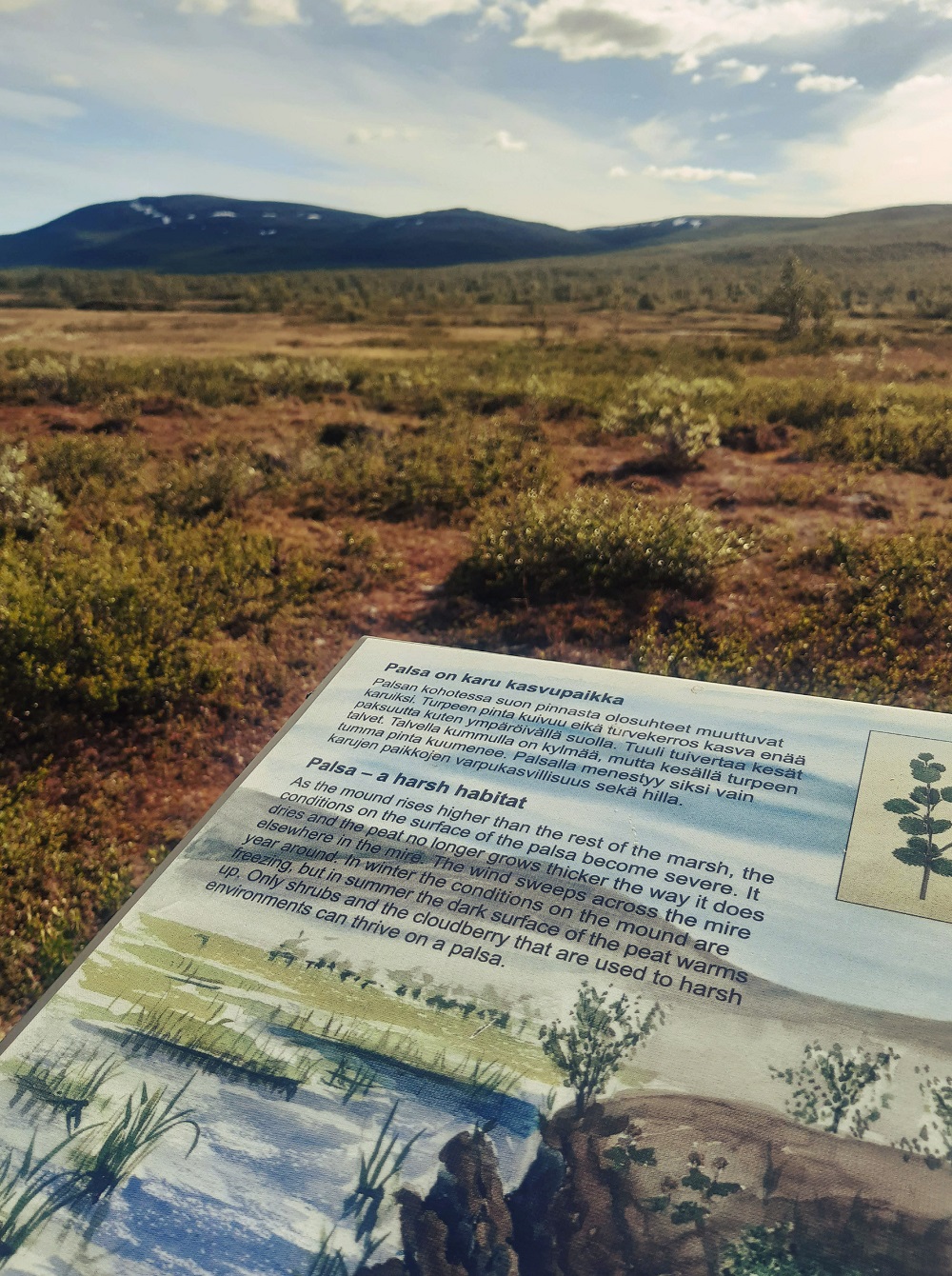
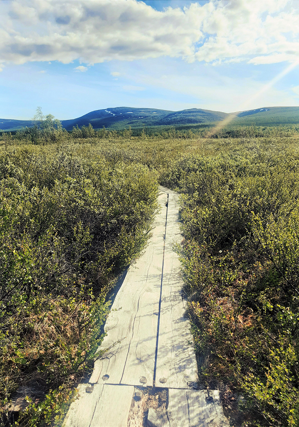

The path begins right by the road. It’s a lovely walk on duckboards to a point where you can view the ‘palsa’ or bog, where there’s year round permafrost. A palsa basically forms in a bog where the average annual temperature is less than -1°C. Imagine permafrost less than a metre below this ground! It was a relaxing area which I recommend checking out.
Arriving at Kilpisjärvi:
The highway was smooth and it was a straightforward route. There’s no way you can get lost as that’s the only route north, along the Swedish border on the left. On the right there is wilderness. Be aware of reindeer on the road always in Lapland! Nearing Kilpisjärvi, the mountain views were very welcoming.


What to do in Kilpisjärvi
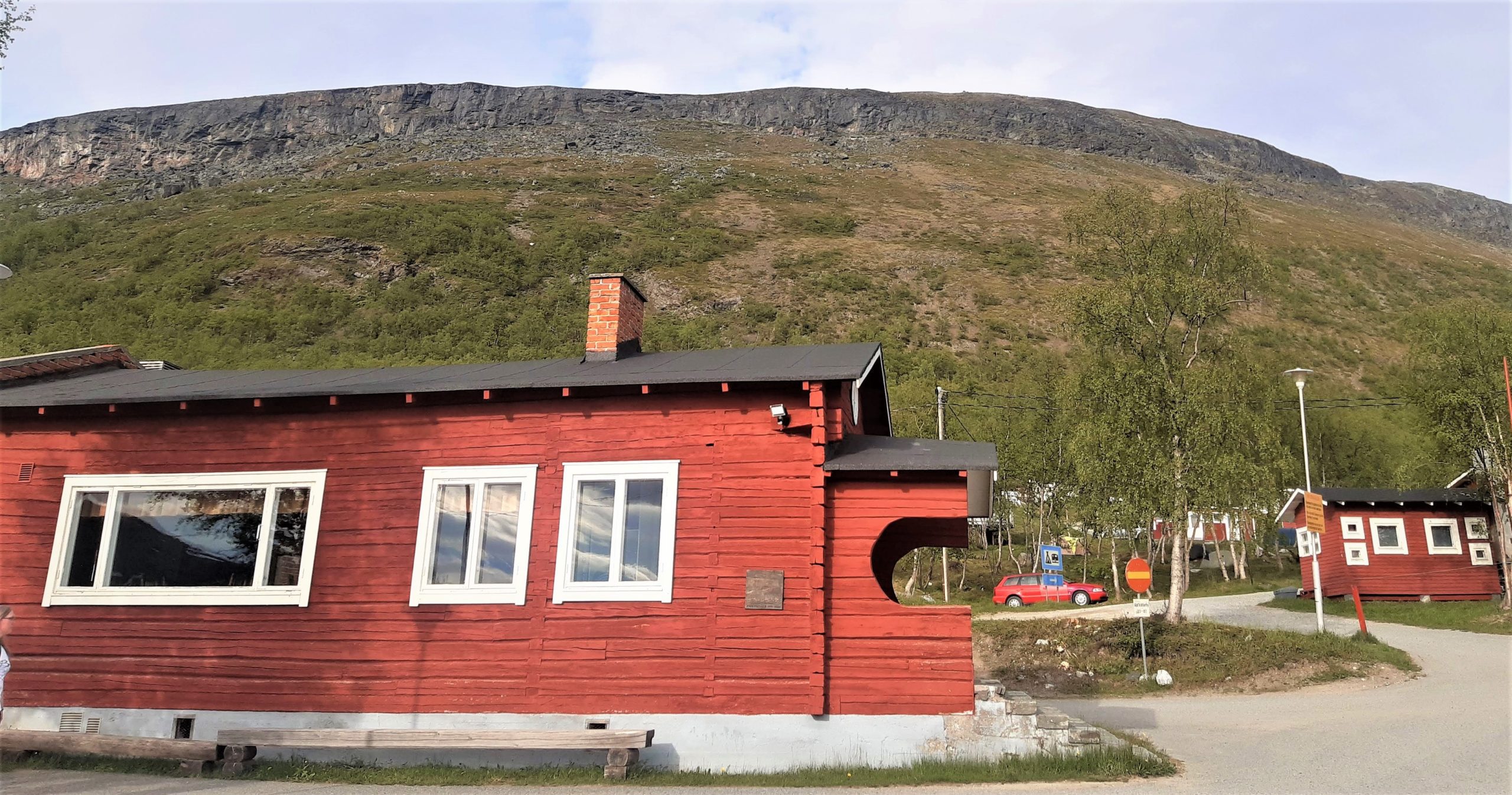
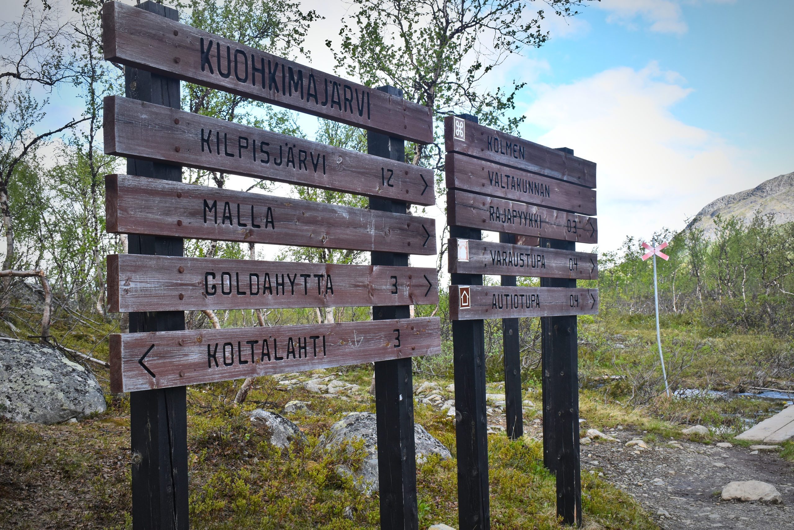
Kilpisjärvi is a fairly small town and the main centre has the tourist and camping centre ‘Kilpisjärven Retkeilykeskus’. Here you can get info, find a spot for your RV or a paid camping space/cabin for the night. We enquired about the prices and it was over 30€ for a tenting spot. We decided to set our tent somewhere else nearby, for free. Here we also found out that the ferry service for the Three Country Cairn had just started operating for the summer season – how lucky! The other option to get there would have been to do a 11km hike and we were not prepared for that.
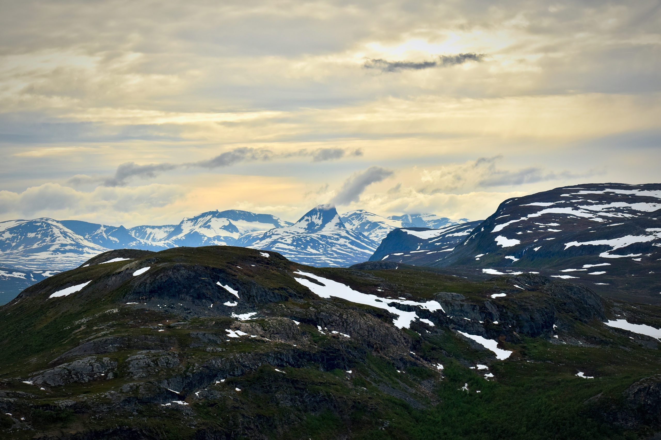
For some good views of the Scandinavian mountains, you can hike up the Saana mountain. There are different routes to take up, depending which end of the mountain you start from. Once we reached Kilpisjärvi, the looming mountain called us to hike up. It’s indeed a must-do when in Kilpisjärvi. The views were lovely and you might get to spot some interesting bird or animal species, like the Norway lemming (Tunturisopuli) 🙂 The only thing we really saw were mosquitos buzzing around us but when you get nearer to the top, it’s windy and they go away.


The hike is easy to intermediate, takes an hour or so to get to the top (1029 metres/3,376 ft). We started from a path near the Kilpisjärvi Camping centre and returned the same way (approx.). We didn’t walk to the highest point across the mountain, as that would have taken a lot more time. It was exhausting and getting late – time to set the tent!
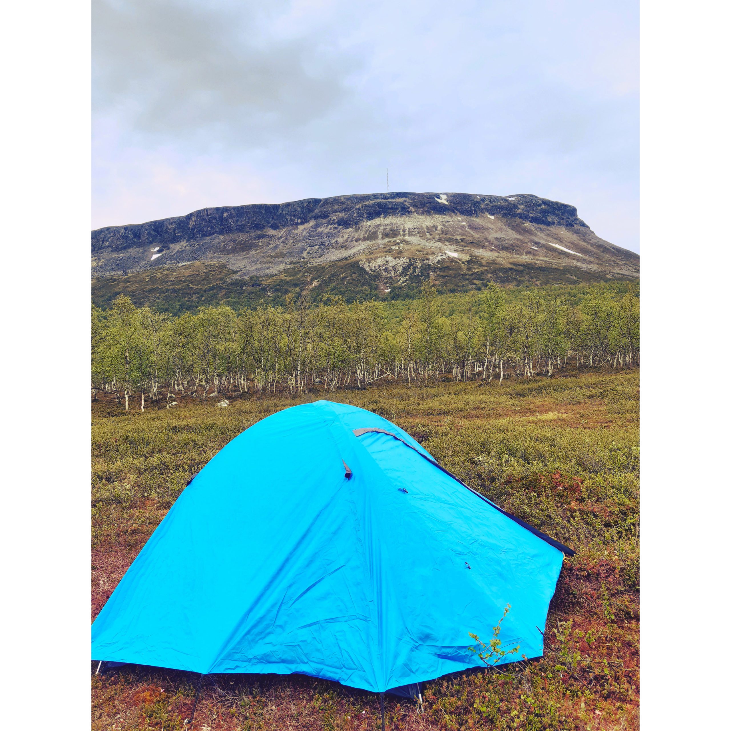
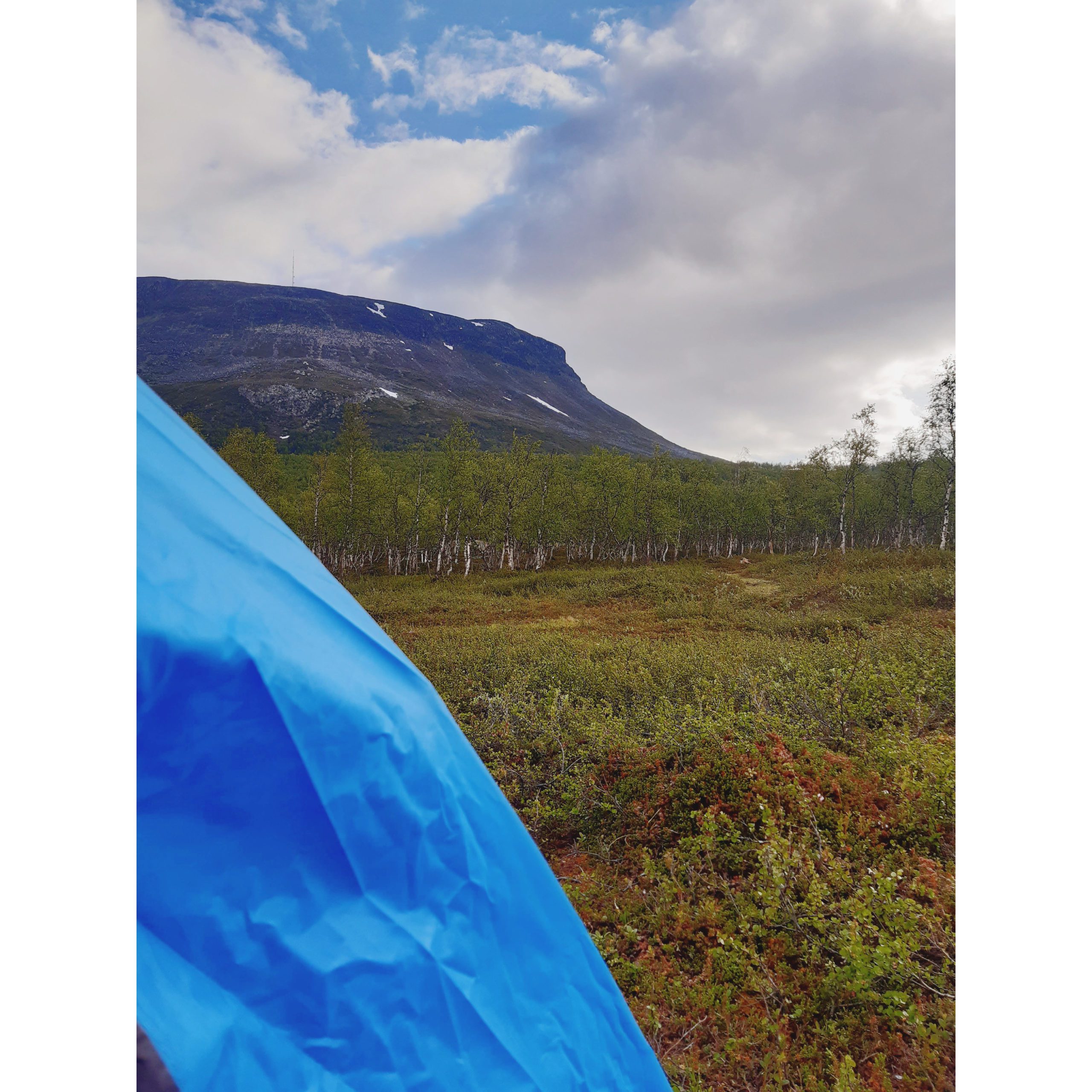
Night in the Tent
In Finland there’s this thing called Everyman’s Right. ”So-called everyman’s rights, refer to the right of everyone in Finland to enjoy outdoor pursuits regardless of who owns or occupies an area. You do not need the landowner’s permission, and there is no charge. However, you must not damage the environment or disturb others while exercising public access rights.” – ymparisto.fi
So why take a paid camping spot with a hundred other campers nearby when you can roam freely and set tent in a place with a better view? We found our place not far from the centre. The important thing was that there was a parking by the roadside to leave our car for the night. From here we climbed up a small slope with our tent equipment and bedding stuff and set up right by the mountain.
Practical Things
Since it was midsummer, it was actually a bit warm, when sunny and it doesn’t really get dark up here! But you will definitely need a light jacket for the weather could go as low as 10°C. If spending the night out in a tent – make sure you have sleeping bags that are warm enough and carry extra blankets too. Also, if you’re not in an assigned camping site, you don’t have access to facilities like a fire. Bring own camping stove, if needed. We managed with the snacks and meals that we packed for the day. For the morning we had TREK protein bars, mixed nuts and went to grab a coffee from the info centre, before heading to the harbour.
In winter, you can take a journey to the Three Country Cairn via snowmobile!
M/S Malla Ferry
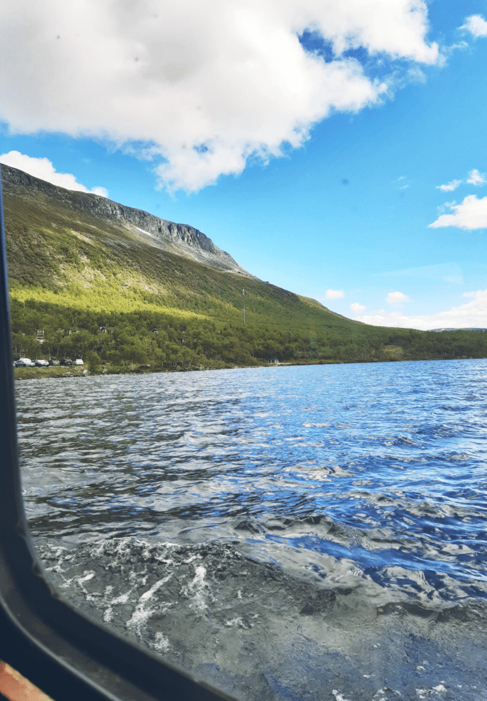
The ferry service runs in midsummer, till late September. It has only 2 departures per day: at 10AM and 3PM. You can find the boat at a small harbour just opposite the Kilpisjärvi camping centre. The ferry waits for you at the drop point and brings you back to Kilpisjärvi in a couple of hours. The boat ride itself takes an hour in total. For us it took much longer because we had to wait for over half an hour for some people on the return trip!
The tickets cost 40€ /person for a roundtrip (yes, so expensive) and are bought when you board the boat. There is also a one-way ticket option for 30€, that is if you want to hike back. Their website for more info.


Note: The hike from Kilpisjärvi to the Three-country cairn is about 12km around Malla nature reserve and you can camp out for the night and hike back the next day, as an alternative to taking the ferry.
People started queuing by 9:30AM, and we felt like we should have been there earlier. The line was long and the wait was long. We wondered if we would even make it on the boat. It seemed pretty tiny, but supposedly fit up to 80 people! There were families with kids, dogs etc. After the long wait, we finally got a spot in and purchased tickets. We left around 10:15 and the journey lasted about 30min.
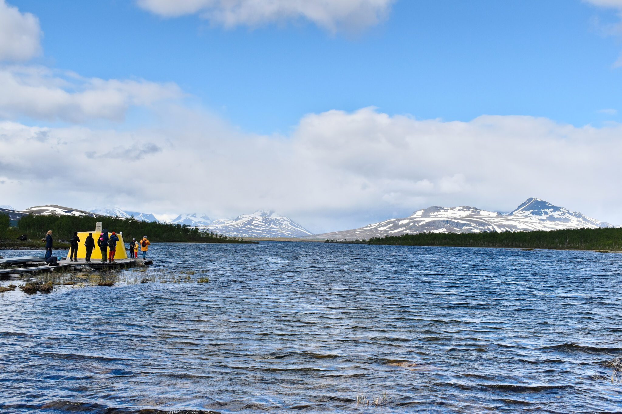
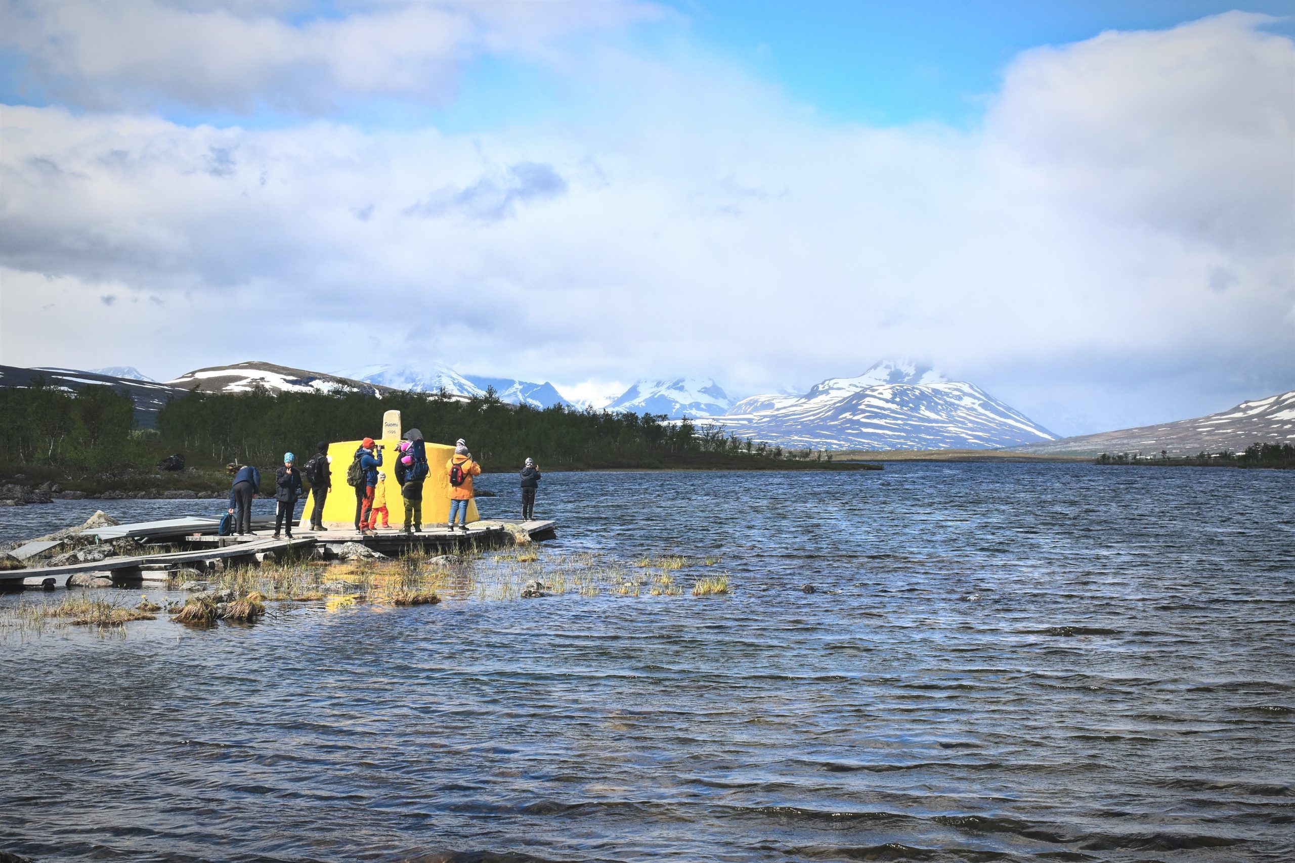
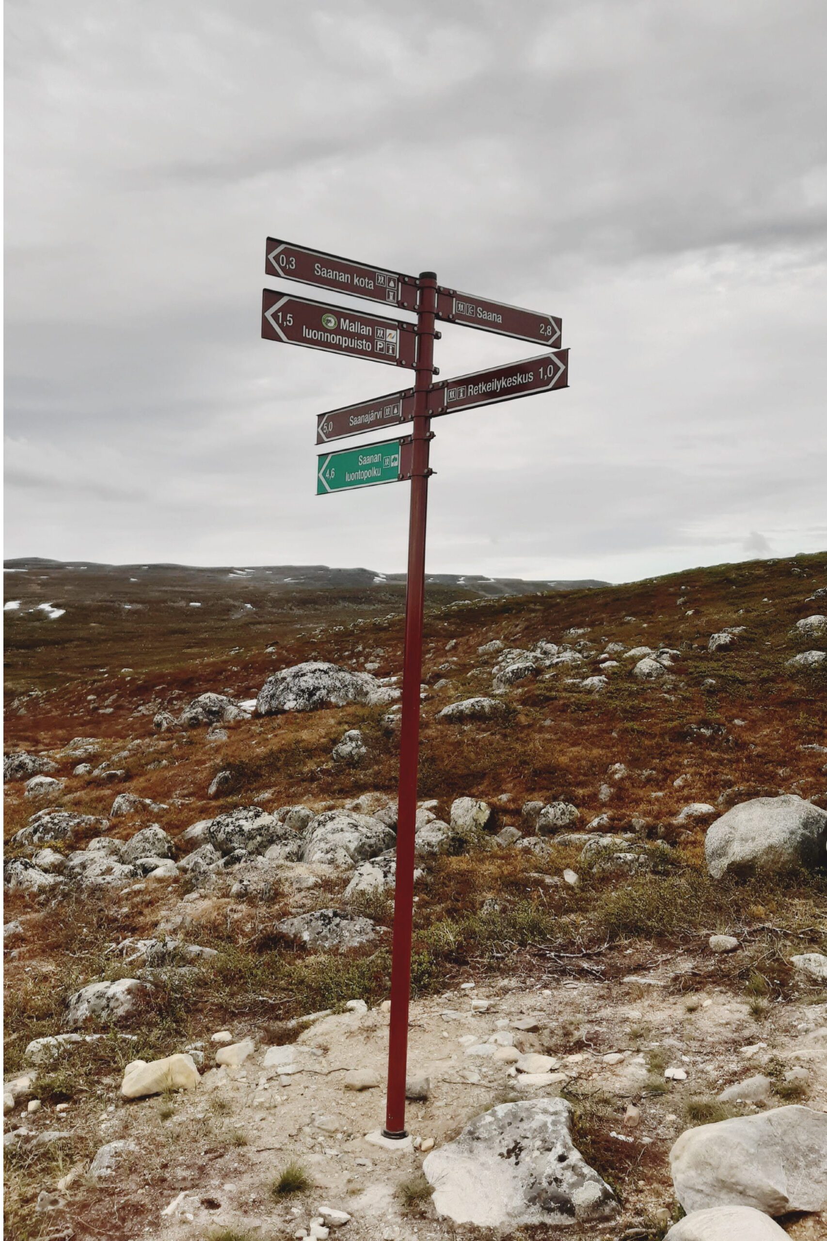
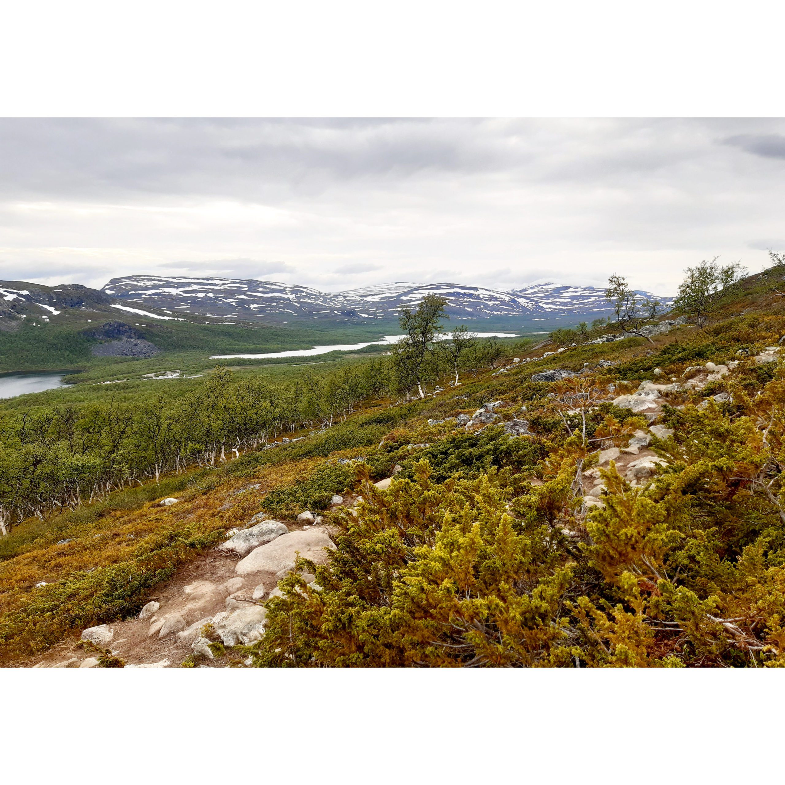
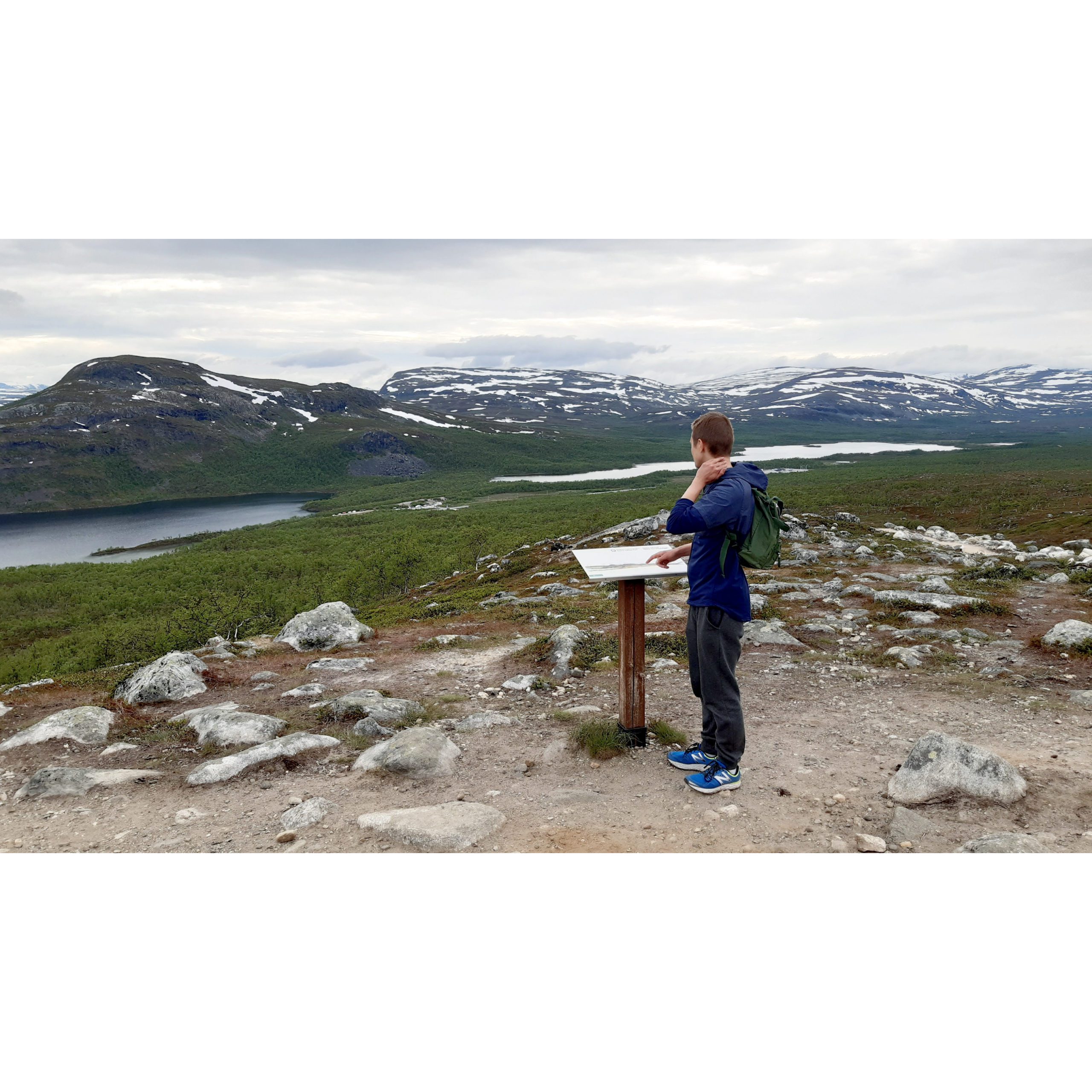
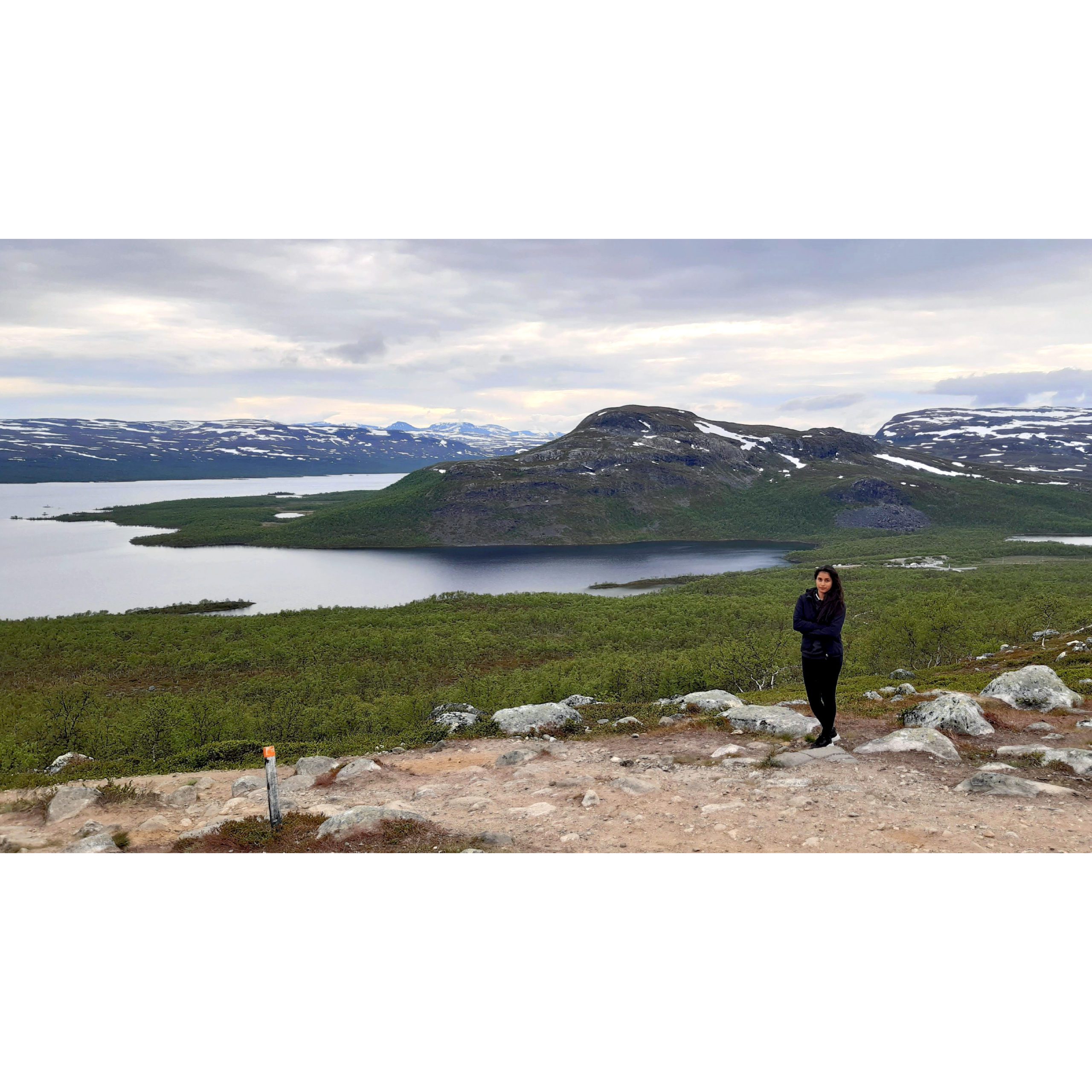
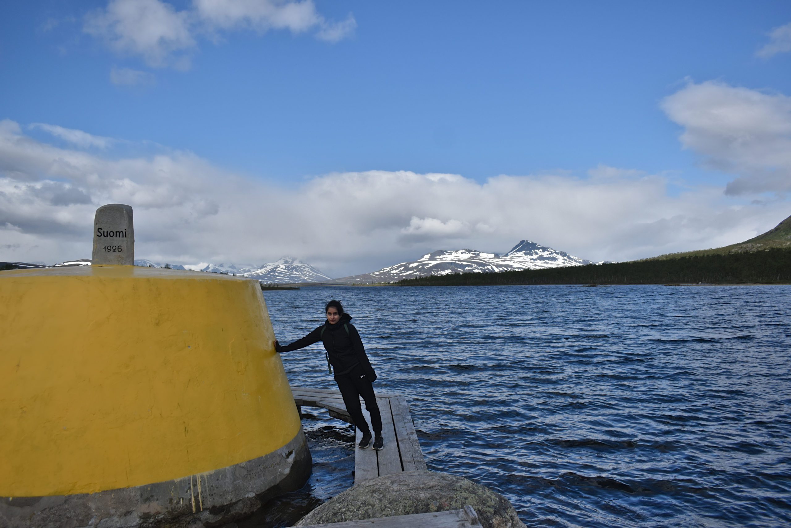
Hike to the Three Country Point
The boat drops us off at a point on land called ‘Koltaluokta’. From here on we have 2 hours to make the hike to the Cairn and back to the boat. After the experience, I would say that this is just enough time to look around, take a few photos, have a snack and get back. The trail takes about 40min one-way. It is a pleasant path, fairly flat and with duckboards over some areas. Beautiful sceneries all around, I’ll let the pictures speak:


View the large individual photos in the gallery by clicking on them.


Back in 1897, a cairn was constructed here by the Norwegians and Russians. The present cairn was built in 1926 on agreement between Norway, Sweden and Finland – the Three Nation Border point!


The end of the journey.
After hiking back, we boarded the return ferry and arrived back at Kilpisjärvi around 2PM. We left the harbour and went straight to the camping centre, where they have a restaurant. Ordered these Beet Burgers(V), which were pretty good. And then started the drive back!

If you have more time in Kilpisjärvi, there’s more to see and do. The Rovijoki waterfall, for example, and the Arctic Ocean and fjords in Norway are only an hour’s drive away (this was our initial plan, and see orcas, maybe!?).
Would you visit the Three-Country Cairn? It’s not your typical adventure but it’s surely something to talk about!
.
.
Liked this post? – consider supporting this blog by Buying Me a Coffee. Any amount of coffee is highly appreciated!
Last updated on September 2nd, 2024
[…] three-country cairn – Visit LyngenfjordThree-Country Cairn – Discovering FinlandA Journey to the Three Country Cairn – […]